The Bridges
There are many bridges in the park and at some time in their history, they were named. You can see their locations and names on the map below. More history and pictures of the bridges follow.
Crowfoot Bridge
One of 3 similar bridges constructed from concrete and metal, presumably installed in the same period in the mid-1950s. It crosses the River Gade so that the eastern and western footpaths are connected. The site is part of the land bought by Watford Borough Council in 1923. Earlier maps show a footbridge, about 45 metres further downstream instead.
Water-crowfoot Ranunculus aquatilis, which flowers from May to June and is poisonous, grows in this part of the river.

Ford Bridge
There was a ford here for animals and carts to cross the River Gade (this is part of the original natural course of the river) with an accompanying wooden bridge for pedestrians. Sloping granite kerbstones on the bend in Gade Avenue indicate the location of the ford.
Use of the ford was stopped by the construction of the new pedestrian bridge, approximately 17 metres upstream from the original wooden pedestrian bridge, possibly in the 1970s. The deck is formed with precast concrete panels on mild steel supports. The bridge barriers were renewed recently with timber / green oak instead of the previous plywood panels.

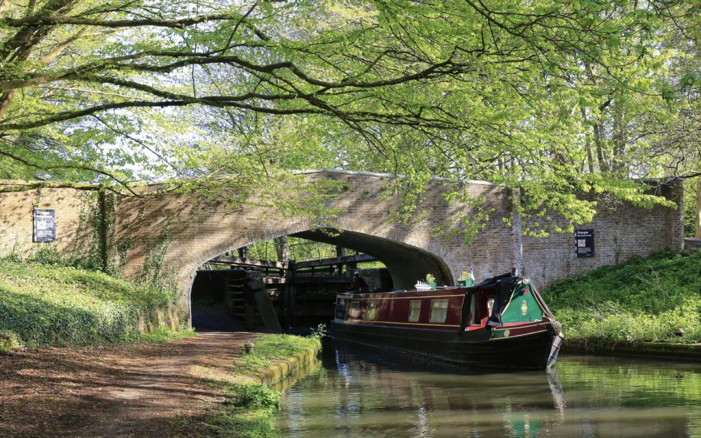
Iron Bridge
More accurately, this is Bridge number 167 at Ironbridge Lock (No.77). No satisfactory explanation has been discovered as to why the lock was named the “Ironbridge” Lock.
The bridge was constructed in brick and stone when this section of the Grand Junction Canal between the River Thames at Brentford and Hunton Bridge was completed in 1797. Described in A Chain Book of the Grand Junction Canal, compiled in 1893 by its Chief Engineer as “Brick arch, wing & waterway walls. Cottages towpath side not Company’s”. The Lock-keeper’s cottages were demolished in the 1950s.
The artist A. C. Pugin depicted the bridge in about 1800, exactly as it is today and an engraving from his artwork was published in Britton, J., (1837) The History and Description, with Graphic Illustrations of Cassiobury Park, Hertfordshire: The Seat of the Earl of Essex. J. M. W. Turner also sketched the bridge in 1809. Pugin’s original has not been traced but Turner’s sketch can be seen at the Tate.
Kingfisher Bridge
One of 3 similar bridges constructed from precast concrete and metal, presumably installed in the same period in the mid-1950s. The site is part of the land bought by Watford Borough Council in 1923. The 1873 map shows a footbridge in this location, which would have been a timber construction.

Little Kingfisher Bridge
Serves the same route as the Kingfisher Bridge, connecting the eastern footpath to the relict Rousebarn Lane, which used to join Rickmansworth Road before Gade Avenue was created in the 1930s. It is constructed with pre-cast concrete decking and metal barriers, probably installed in the mid-1950s as it is like the Little Meadow Bridge. The 1873 map shows a footbridge, in this location, which would have been a timber construction.

Little Meadow Bridge
In 2023 the short-span bridge installed in the mid-1950s and constructed from metal with precast concrete decking was replaced by an earth bridge with culverts. This gave access to the wetlands for large machinery in order to excavate the site. The site was originally acquired by Watford Borough Council in 1923 and there is no evidence of a bridge in this location on maps before this. It spans streams that mark the course of the relict River Gade, before the diversion of the river in the early 19th century and provides access to the meadow from the footpath on the west side. However, the area is low-lying and is frequently underwater.


Meadow Bridge
This footbridge gives access to a meadow, contained within an artificial meander in the River Gade, formed in the early part of the 19th century. It was possibly suggested to the Earl of Essex by the Landscape Gardener, Humphry Repton. The land within was named “Pheasant Meadow” on a map published in 1873. It is likely that it was managed for shooting but in earlier times, water meadows were cultivated to provide crops of hay for animal feed. In 1873 there was a footbridge 45 metres downstream from the present one.
Watford Borough Council bought the land in 1923. An early 20th-century postcard shows a bridge of timber construction but the present bridge is one of 3 similarly constructed from concrete and metal, in the mid-1950s.

Northern Reserve Bridge
A simple boardwalk-style bridge to give access to the reserve.

‘Pooh’ Bridge
Almost certainly named because of similarities to the bridge where Pooh Bear and his friends played “Pooh Sticks” in “The House at Pooh Corner” by A. A. Milne (1928). The author invented the game for his son at the real Posingford Bridge in Ashdown Forest, East Sussex. The Cassiobury Pooh Bridge has precast concrete decking, which is probably contemporary with the various other mid-1950s bridges and doesn’t appear in maps before 1960. The barriers are wooden and have probably had to be renewed more than once in its life.

Rousebarn Lane Canal Bridge
The bridge dates from the opening of the section of the Grand Junction Canal between the River Thames at Brentford and Hunton Bridge in 1797. The bridge bears the number 168 and A Chain Book of the Grand Junction Canal, compiled in 1893 by its Chief Engineer describes it as “Brick abut. wings & waterway walls wooden top. Public road”. Rousebarn Lane originally joined the Rickmansworth Road, until Gade Avenue became a public highway, probably in the 1950s. It was an old route connecting Cassiobridge to Chandlers Cross and formed the north-western boundary of the estate of the Earls of Essex and now the present public park.
The original timber deck would have been replaced during the 19th century and there is evidence that the brick abutments have been strengthened. The deck was renewed in 1975 with reinforced concrete and the barriers were recently replaced using green oak.

Rustic Bridge
This crossing point of the original natural course of the River Gade is probably very old and had been a ford for carts and animals to cross. An 1873 map shows a bridge in the present location and the ford immediately upstream.
An early 20th-century photograph shows that the barriers were made from ‘round wood’ in a ‘rustic style and the name seems to have ‘stuck’, despite all the later versions using squared timber in a simpler design of vertical posts.
The present bridge was refurbished in 2019, including strengthening the deck and new barriers with geometrically designed panels of interlocking green oak. Earlier barriers can be seen in old photographs and prior to the recent refurbishment, parts of the balustrade had been carved (c 2000), with animals and birds that could be seen in Cassiobury Park.

")

Scrape Bridge
Situated on the path following the southern/western bank of the river, on the edge of the Meadow, it was first constructed of timber in 2010, when an ORSU (off-river support unit) for fish was made. A ‘scrape’ is an artificial, shallow inlet from the river to allow fish to access the ORSU and the bridge carries the footpath across a ‘scrape’.
The existing bridge is expected to be renewed as part of the Wetland scheme.


Watercress Bridge
A simple concrete deck supported by precast concrete culvert pipe. This is the only vehicular access to the watercress beds in the southern reserve when they were farmed commercially, until 1990. The bridge spans a stream that marks the course of the relict River Gade before it was diverted in the early 1800s.

Thank you to Stephen Smith for taking new photographs of all the bridges and Laurie Elvin for researching their history and providing most of the text.